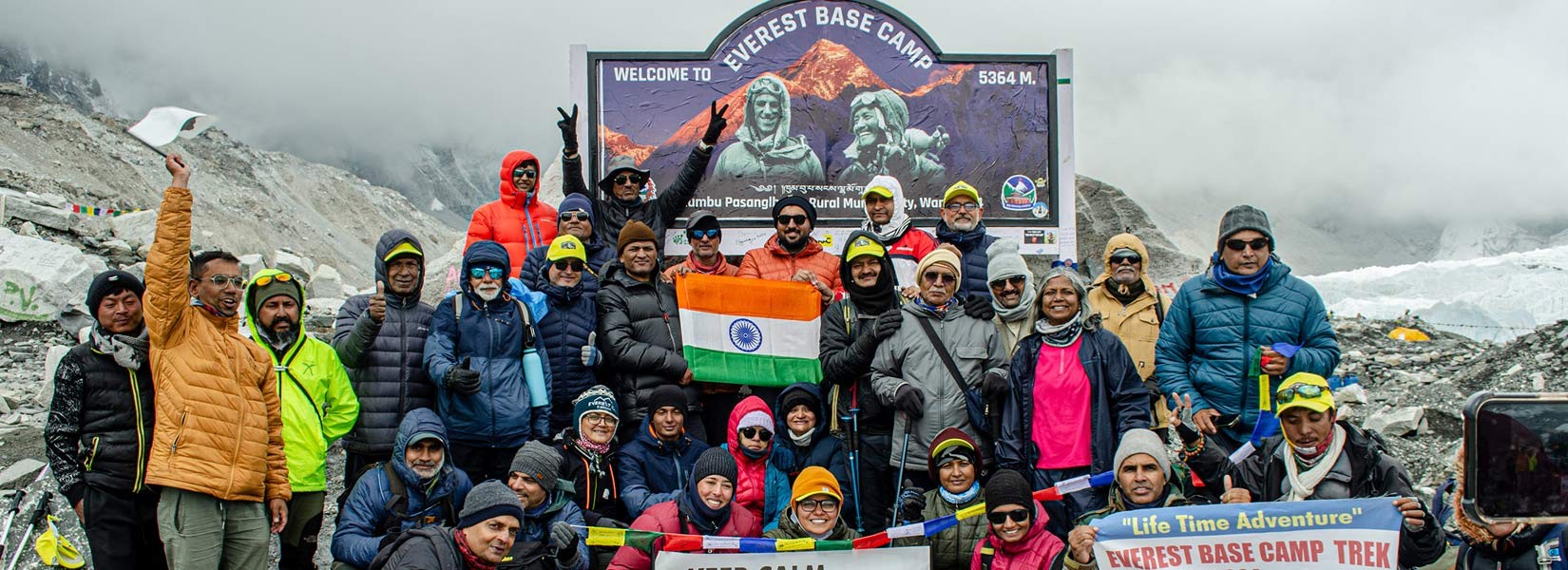
Everest Base Camp Trekking Itinerary Highlights
From Lukla's thrilling arrival to Namche Bazaar's bustling heart, your ascent unfolded. You traversed rugged terrain, crossed suspension bridges, and witnessed the Sherpa community's vibrant culture. Each step brought you closer to the legendary peaks, their snow-capped summits igniting awe and inspiring determination.
Acclimatizing days in Namche and Tengboche offered opportunities to delve deeper. You explored Sherpa villages, marveled at the Khumbu Icefall, and experienced the spiritual serenity of Tengboche Monastery. These experiences enriched your understanding of this unique region and its people.
The climb to Dingboche and Lobuche tested your physical and mental fortitude. Yet, the breathtaking panoramas of Ama Dablam, Pumori, and Nuptse fueled your spirit. Overcoming challenges, you reached Lobuche, the gateway to your ultimate goal.
Reaching Gorakshep and Kala Patthar marked the culmination of your journey. The grueling ascent rewarded you with the sight of Everest, its grandeur exceeding any imagination. Standing on Kala Patthar, bathed in the golden light of dawn, you felt the world beneath your feet and the sky within your reach.
Descending through Pangboche, Namche offered a bittersweet farewell. The familiar trails now held new meaning, each step echoing with the memories you created. As you returned to Lukla, the elation of achievement mingled with a touch of sadness at leaving this incredible landscape behind.
But your Everest Base Camp trek was more than just a physical feat. It was a journey of self-discovery, resilience, and connection. You pushed your boundaries, embraced challenges, and witnessed the beauty and fragility of nature. You connected with the Sherpa community, learning about their culture and traditions.
As you depart Nepal, carry these experiences in your heart. Let the spirit of the Himalayas, the kindness of the Sherpa people, and the awe-inspiring mountains continue to guide you on your life's journey. Remember, the summit may have been Everest, but the true victory lies within you, in the courage, determination, and resilience you discovered along the way.
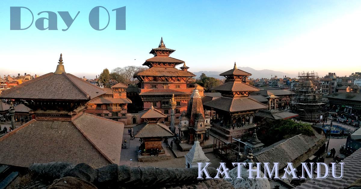
Day 01: Your first day in Nepal (Arrive at Kathmandu airport)
You need more patience. The airport is small, so don't expect nitty-gritty, super-fast clearance like other airports. During peak seasons like February, March, April, May, October, November, and December, you might have to wait quite longer than you had expected. The visa queue and another baggage collection section are quite annoying, so try to meditate yourself. People are helpful, but things are quite slow inside, not advanced and updated. Sometimes you need to go through a manual for the visa process.
Is the visa on arrival at the airport?
Yes, please carry a P.P.-sized photo with you just in case the electronic machine doesn't work.
Cards are accepted, but it's better to carry some cash with you. Visa fees cost USD 30 for 15 days, and for 30 days they cost USD 50. For Indian citizens, you don't need to get a visa; just clear immigration. If you have time back home, you can even apply for a visa online, Follow the link: http://www.online.nepalimmigration.gov.np/tourist-visa
How far will my hotel be, and will there be anyone at the airport to receive me?
The hotel will be about 6–9 km from the international airport, and it takes 20–30 minutes to reach your hotel. Yes, airport pickup is included, and some of our staff will be at the airport. Normally, the hotel accommodation will be in Thamel, so after checking in to your hotel, a short briefing about the plan, and a meeting with your guide, you can walk around in nice restaurants for food or buy trekking gear if you forgot to keep it in your bag.
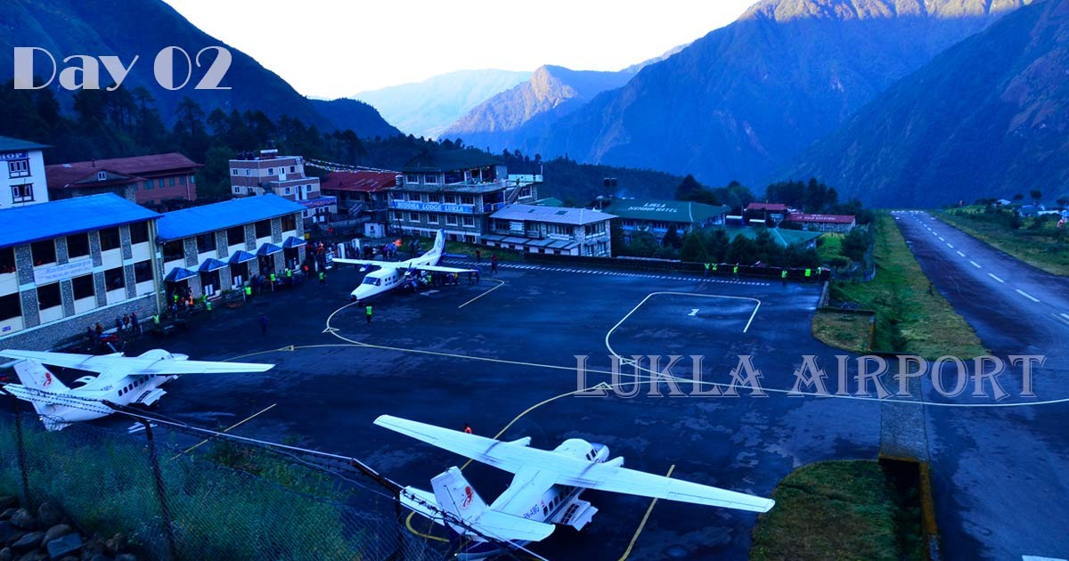
Day 02: Kathmandu Drive to Manthali Airport, Fly to Lukla.
- Elevation of Lukla: (2,800 m) 9,184 ft
- Elevation of Phakding: (2,652 m) 8,698 ft
- Total distance from Lukla to Phakding: 8 km, 4.97miles
- Hours of walking from Lukla to Phakding: 4 hours
- Lunch spot: Somewhere in between, Thadokoshi or Ghat.
- Overnight at: Phakding village.
Your flight will be early in the morning, so your packed breakfast will be ready at the reception; don't forget to collect it. The guide and vehicle will be right on time, and it will be a short drive to the domestic airport "Kathmandu" (but in the peak season, the flight to Lukla will be from Manthali airport, and it will be a 4-hour drive) for the Lukla flight. We will meet the rest of the team (Porters and Sherpa) in Lukla, and after a short introduction, the journey to Everest starts from here.
The Thrilling Journey from Kathmandu to Phakding:
Begin your exciting journey to Everest Base Camp by arriving at Lukla Airport, which is located in the heart of the majestic hills. Come and experience the breathtaking beauty of Mount Numbur, Kongde, and Lukla village nestled on a mountainside.
Explore the charming Sherpa settlements, taking in the beauty of their traditional architecture and the fascinating Tibetan Buddhist landmarks such as temples, mani walls, and prayer flags. Take a deep breath of the crisp mountain air while strolling next to the Dudhkoshi River, traversing suspension bridges, and seeing the vibrant prayer flags.
The majestic sight of Mount Kusum Kangaru on the horizon will greet you as you ascend from Thadokoshi. It's truly a breathtaking reward for all your hard work and effort. Finally, you'll arrive at Phakding, which is the starting point for your journey to Everest Base Camp.
How many suspension bridges are there on the Everest Base Camp Trek?
There are nine suspension bridges on the way to reach Everest Base Camp Trek while doing the Everest Classic Trekking routes. Some people have a height phobia and are scared of crossing these bridges, so it's better to be prepared if you have that problem. Our guides normally carry those people who get scared on these bridges.
The exciting moments of the day
- Experience the excitement of landing at Lukla airfield, where you'll find a mountain airfield with a short runway.
- Explore Sherpa communities and experience the vibrant culture and beautiful traditional architecture.
- Explore the enchanting allure of Tibetan Buddhist structures, where you may immerse yourself in the serene splendor of monasteries, mani walls, and prayer flags.
- Enjoy the breathtaking views of Numbur, Kongde, and Kusum Kangaru, three magnificent mountain summits.
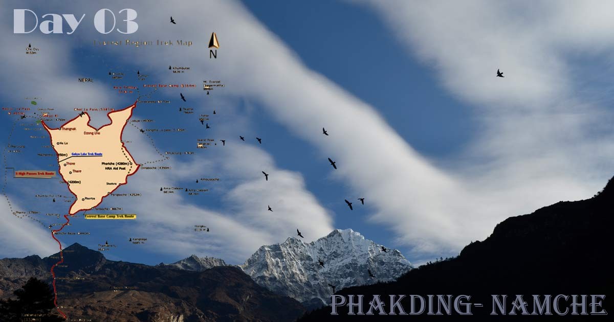
Day 03: Phakding Trek to Namche Bazaar.
On the second day of your Everest Base Camp trip, you'll experience a tough but intriguing climb from Phakding to Namche Bazaar, which is the lively centre of Sagarmatha National Park. Get ready for a challenging climb with an elevation increase of around 4,000 feet (1,200 metres). This makes it one of the toughest climbs in terms of altitude on the entire route. Just keep going, and you'll be amazed by the incredible reward waiting for you at the finish. When you arrive at Sagarmatha National Park, get ready to have your trekking permits and TIMS cards checked (our guides will handle this). Welcome to the official checkpoint! You are now entering the protected territory, which is home to the magnificent Mount Everest.
- Elevation of Namche Bazaar: (3,440 m) 11,283 ft
- Total distance from Phakding to Namche: 10–12 km
- Hours of walking from Phakding Namche Bazaar: 6 hours
- Lunch spot: Monjo
- Overnight at: Namche Bazaar
Finally, you reach Namche Bazaar, a welcoming place to rest after a tough but fulfilling climb. Experience the charming ambiance of the mountain town, take in the stunning vistas, and allow the beauty of nature to uplift your spirit. The trip from Phakding to Namche Bazaar is not just a simple climb; it's an adventure that you will always remember. Get ready to explore Namche Bazaar, a lively mountain town filled with culture, commerce, and places to stay. Enjoy the following two nights discovering its vibrant alleys, indulging in the delicious local Sherpa food, and getting used to the greater altitude.
Just a friendly reminder:
- Getting used to the conditions at higher altitudes is really important.
- Feel free to take your time, stroll at a leisurely pace, and pay attention to what your body is telling you.
- Make sure you stay hydrated and properly nourished on the walk.
- Drink plenty of water
- Please be mindful of the local culture and environment.
Highlights of the day
A melting pot of trekkers and Sherpas: As you set off from Phakding, the trail comes alive with a diverse mix of fellow adventurers and friendly Sherpa locals. Witness their resilience and unique way of life as they navigate the terrain with ease.
Treasure trove of handicrafts: Phakding boasts a vibrant market where you can discover exquisitely crafted souvenirs and handmade woolen goods. Support the local community by taking home a piece of their artistic heritage.
Charming architecture and bustling energy: Quaint huts and traditional Sherpa buildings line the path, adding an undeniable charm to the journey. Immerse yourself in the bustling atmosphere of Namche Bazaar, a hub for trekkers and a centre of Sherpa culture.
Nature's grandeur unfurls: Breathe in the crisp mountain air as you traverse valleys, cross gushing rivers, and gaze upon awe-inspiring high mountains. The views of snow-capped peaks like Ama Dablam and Nuptse will leave you breathless.
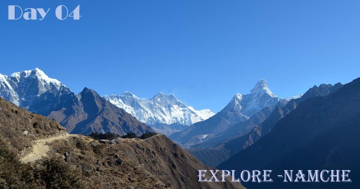
Day 04: Exploring Namche Bazaar (Acclimatization Day)
Even though today's schedule is called a "rest day," it's definitely not boring. Instead, let's go on an exciting adventure, exploring beyond the busy streets of Namche Bazaar and into the beautiful Himalayas. Popular nearby places from Namche Bazzar:
Syangboche Airstrip
Are you ready to experience more stunning views? Get ready to put on your hiking boots and head to the Syangboche Airstrip, which is located at an impressive altitude of 3,780 metres. From this viewpoint, the Himalayas stretch out in front of you like a beautiful tapestry made of snowy mountains. Keep an eye out for the famous triangle formed by Everest, Lhotse, and Nuptse; their breathtaking beauty will leave you in awe. Keep going on your adventure to the Everest View Hotel, where you can treat yourself to a much-deserved cup of tea while enjoying the breathtaking scenery that motivated your ascent.
Everest View Hotel. Picture yourself enjoying a nice cup of steaming tea as you admire the breathtaking view of Mount Everest, with its snow-covered summit glowing in the beautiful morning sunlight. It's a moment that you will always remember.
Discovering the Sherpa Essence: Khumjung and Khunde After seeing the awe-inspiring beauty of Everest, we will make our way down to the charming villages of Khumjung and Khunde. Explore these charming traditional settlements to get a look into the genuine lives of the Sherpa people, who are well-known for their strength and skill in mountaineering. Explore the charming cobbled streets, where you'll see beautiful stone cottages decorated with prayer flags that dance in the breeze. Come and explore the Khumjung Monastery, where you can see the famous Yeti scalp (whether it's a story or truth is up to you!). Immerse yourself in the peacefulness of the beautiful mountains that surround it.
Discovering Sherpa Culture: A Rich Tapestry of Traditions; Namche Bazaar is a lively hub of different cultures, and it's a must to fully experience the diverse Sherpa traditions. Come and explore the Sherpa Culture Museum, where you can experience the fascinating stories of their history, religious beliefs, and one-of-a-kind way of living. Explore the lively Saturday market, filled with a variety of colors and textures. Hey there! You'll discover a wide range of items, ranging from beautifully crafted yak wool scarves to exquisitely carved prayer wheels. Each piece showcases the incredible talent and creativity of the Sherpa community.
When the sun sets and creates long shadows on the Himalayan mountains, you'll come back to Namche feeling amazed and with a better appreciation of this beautiful place. Today's adventures have been more than simply a hike; they've been a journey into the heart of the Himalayas, a wonderful opportunity to connect with its people and its stunning beauty.
- Elevation of Namche Bazaar: (3,440 m) 11,283 ft
- Total distance distance of Namche exploring: 6-7 km
- Hours we will be exploring: 4-5 hours
- Lunch spot: Khumjung village
- Overnight at: Namche Bazaar
Just a friendly reminder: this schedule is simply a guideline, and you have the freedom to customize it according to your own interests and preferred pace. If you're looking for some excitement or just want to enjoy the beauty of the mountains, Namche Bazaar and the surrounding area provide a variety of options for everyone.
What is Namche Bazaar famous for?
Situated among towering Himalayan peaks such as Ama Dablam and Nuptse, Namche Bazaar is not only a mere resting place for those aspiring to conquer Everest. This old trading area, which used to be a busy hub between Tibet and Nepal, still has its appeal with vibrant markets where you can find yak cheese and handicrafts. Experience the rich Sherpa culture, enjoy stunning mountain vistas, and adjust to the altitude before exploring higher areas. Namche is a great starting point for hikes such as Gokyo Ri and the Three High Passes. It's also a pleasant surprise with its charming pubs, bakeries, and lively atmosphere, similar to Thamel. Whether you're a passionate explorer or looking for a special alpine getaway, Namche Bazaar is ready to welcome you with open arms (and delicious yak butter tea!).
Namche Bazaar is a popular destination for those who just want to see Mount Everest with their naked eyes, so if you don't want to hike all the way up to Everest Base Camp or don't have enough time, then Namche Bazzar Hike is the best option.
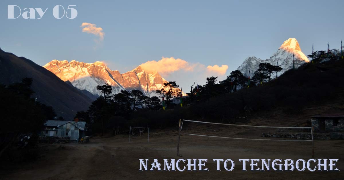
Day 05: Namche Bazaar to Tengboche Monastery.
- Elevation of Tengboche Monastery: (3,870 m) 12,684 ft
- Total distance from Namche to Tengboche: 10 km
- Hours of walking from Namche Bazaar to Tengboche: 6 hours
- Lunch spot: Kyangjuma or Phunmgi Thanga
- Overnight at: Tengboche
Starting your journey from Namche Bazaar, after a delicious breakfast at a teahouse, you will explore the beautiful Sagarmatha National Park. Explore a stunning valley as you listen to the melodic sound of yak bells and watch the confident steps of porters. The trail follows closely along the valley wall, showing a sandy path that becomes steeper as you climb. From there, you can enjoy breathtaking views of Ama Dablam and other majestic Himalayan mountains, including Lhotse, Nuptse, and Mt. Everest.
Next, we will enter a refreshing forested area where the tall mountains are temporarily hidden by the rustling leaves. Explore the bumpy landscape with suspension bridges that bring an exciting element to your journey. Make sure to watch for the checkpoint before the trail goes uphill again. There will be a bunch of turns that can challenge you, but you'll also get to see some amazing views.
Finally, the path gets steeper as we go higher, reaching above the area where trees grow. Here, the snowy mountain tops show out against the blue sky. As we reach the end of our journey, Tengboche appears in front of us, a lovely settlement surrounded by this stunning view. Welcome to your cozy retreat for the night! Here, you can relax and enjoy the peaceful atmosphere of Tengboche Monastery. Its beautiful golden roof shines in the sunlight, offering a serene setting. You'll also get the opportunity to see the rich culture of the Sherpa people, which has stood the test of time.
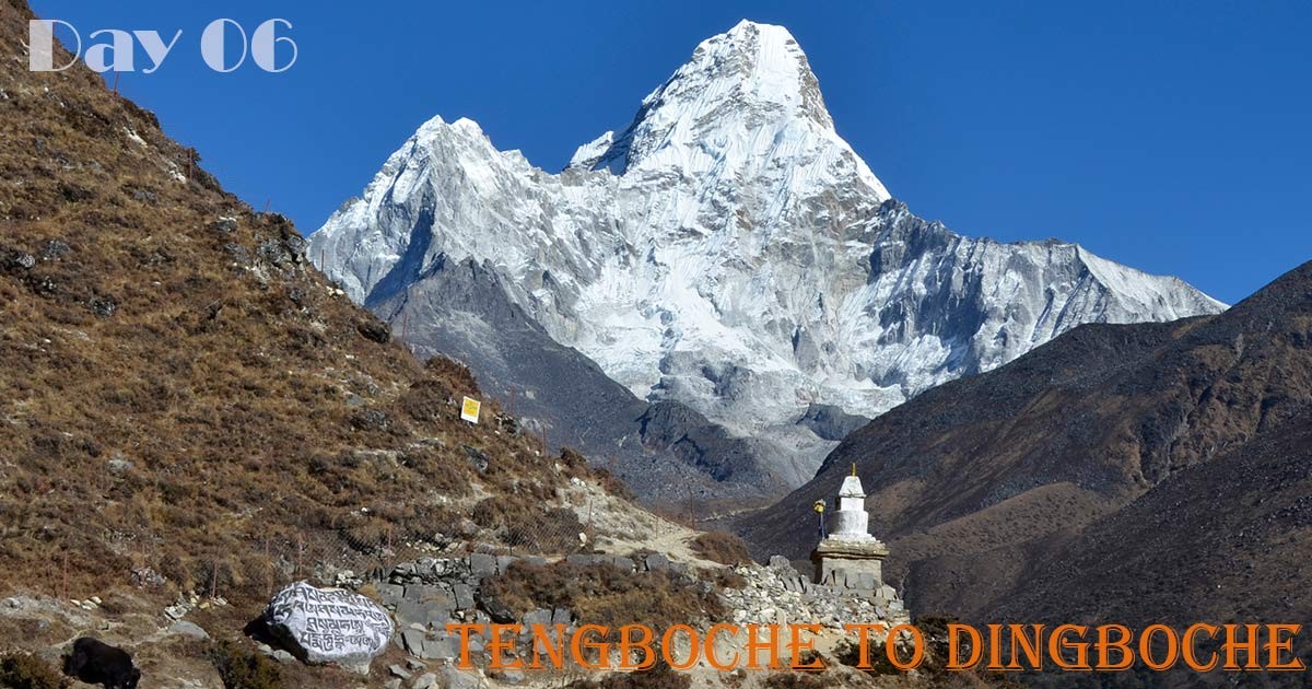
Day 06: Tengboche Trek to Dingboche
- Elevation of Dingboche: (4,400 m) 14,435 ft
- Total distance from Tengboche to Dingboche: 11 km
- Hours of walking from Tengboche to Dingboche: 6 hours
- Lunch spot: Pangboche or Shomare
- Overnight at: Dingboche
The trek from Tengboche to Dingboche offers stunning Himalayan scenery. Starting with a downhill trail along a glacier river, you pass through Pangboche village, nestled beneath Mt. Ama Dablam. After a morning prayer ceremony at Tengboche Monastery, the trail gently ascends, passing villages like Deboche and Shomare.
Enjoy breathtaking views of Lhotse, Nuptse, and Ama Dablam from viewpoints along the way. Cross a suspension bridge before reaching Dingboche, your stop for the night. Relax in a teahouse and explore the village, preparing for your next adventure.
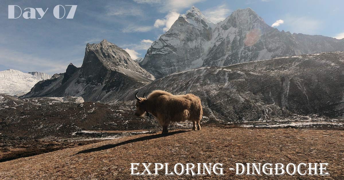
Day 07: Acclimatization day in Dingboche
- Elevation of Dingboche: (4,400 m) 14,435 ft
- Hours of walking around Dingboche: 3 hours
- Overnight at: Dingboche
Dingboche offers stunning Himalayan views and various acclimatization options. Hike Nangkartshang Peak, exploring Sherpa communities and witnessing vibrant prayer flags along the twisting path. Reach the summit (5083m) for panoramic vistas of mountains, glaciers, and rivers. Acclimatize to the altitude and experience the diverse landscape, facing challenges on the rugged terrain.
Enjoy breathtaking views of alpine lakes and glaciers from the peak, prepared for frigid conditions. After descending the slippery path, explore the picturesque villages near Dingboche.
Note: This is a flexible plan, adapting to your comfort level and preferences in discussion with your Sherpa guide.
Is there a hospital near Dingboche?
- Yes the Hospital is in Pheriche village
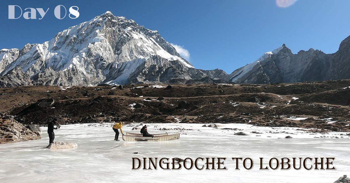
Day 08: Dingboche Trek to Lobuche
- Elevation of Lobuche: (4,900 m) 16,076 ft
- Total distance from Dingboche To Lobuche: 8.5 km
- Hours of walking from Dingboche to Lobuche: 5–6 hours
- Lunch spot: Thukla
- Overnight at: Lobuche
With towering peaks like Tanbuche and Ama Dablam all around, our trip from Dingboche begins in peace and quiet. The trail lowers and passes a river after stopping to take in the view, but then the real test starts—a tough climb up to Thukla. Before ascending the steepest slope yet, take a break here for lunch and relaxation. Recall that Dugla Pass is more challenging because of the low oxygen levels.
Proceed beside the Khumbu Glacier after paying your respects at the climbers' memorial at the summit. See Kala Patthar for the first time—the fruit of your laborious efforts. The rest of the path is lined with sharp rocks and stones, but don't lose heart—Lobuche is only a 30- to 40-minute drive away. Wondering at the vast views that suddenly appear in front of you replaces the agony.
Arriving at Lobuche, a tiny village tucked away in the mountains, seems like a victory. The lodges provide unexpected luxury and breathtaking views of the surrounding peaks and glaciers, despite their isolated location.
Important: Listen to your body throughout the trek. Headaches and discomfort can be warning signs of altitude sickness. If you experience these, inform your guide immediately. Stay hydrated and eat even if you have no appetite. Remember, pushing yourself too hard can jeopardize your safety and enjoyment of the trek.
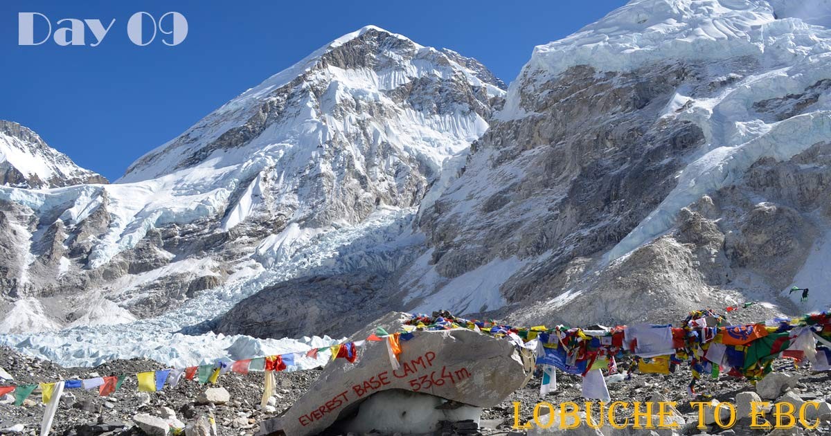
Day 09: Lobuche Trek Gorakshep and Day Hike to Everest Base Camp
- Elevation of Gorakshep: (5,164 M) 16,942 ft
- Total distance from Lobuche to Gorakshep Everest Base Camp (Gorakshep): 12 km
- Maximum Elevation: (5,364 M) 17,596 ft (Everest Base Camp)
- Hours of walking from Lobuche to Everest Base Camp - Gorakshep: 7-8 hours
- Lunch spot: Gorakshep
- Overnight at: Gorakshep
The last destination before the famous base camp, Gorakshep, is where your Everest Base Camp trip continues. Enjoy the majesty of the Khumbu Glacier and the breath-taking views of Everest and the surrounding peaks as you travel.
You will be traversing a portion of the Khumbu Glacier, but don't be concerned—the pebbles and sand offer good traction. The teahouses of Gorakshep soon come into sight, providing a place for you to recover before the last push. Set out on the thrilling 4-hour round-trip journey to Everest Base Camp after lunch. Stroll beside the Khumbu Glacier and take in the striking scenery and expansive vistas. The trail is rocky and uneven, even if it is not steep; there are sections when it crosses the glacier.
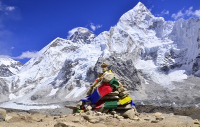
See the breathtaking Khumbu Ice Fall, where climbers to the summit of Everest begin their journey, and lastly, the recognizable rock that designates Everest Base Camp. Celebrate your success under vibrant prayer flags and take pictures to commemorate this special day. Since the base camp does not offer lodging, return to Gorakshep while savoring the memories and stunning views of the mountains.
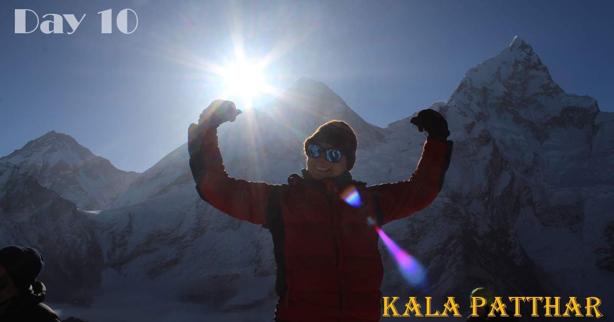
Day 10: Gorakshep Morning Hike to Kala Pathar and Trek to Pangboche
- Elevation of Pangboche: (3,985 M) 13,074 ft
- Total distance from Gorakshep to Kala Patthar Pangboche: 22 km
- Maximum Elevation: (5540 M) 18,176 ft (Kala Patthar)
- Hours of walking from Gorakshep Kala Patthar to Pangboche: 7-8 hours
- Lunch spot: Thukla or Pheriche
- Overnight at: Pangboche Village.
Reach Kalapatthar, the 5,540-meter "black rock" viewpoint, the last frontier of the Everest Base Camp hike. Experience an unparalleled reward by embarking on a strenuous two- to three-hour climb through tough terrain to greet dawn. View Pumori, Changtse, and Khumbutse, three magnificent peaks that surround Mount Everest, the crown jewel of the Himalayas, in all their splendor. Savor the dreamy splendor of the dawn as it paints the sky a rainbow of hues.
Descend the Kalapatthar route and relish the expansive views that will always stick in your mind. Get ready for a two- to three-hour hike to the quaint settlement of Pangboche, which is tucked away in the Imja Khola Valley. Despite being difficult due to the jagged rocks, the walk provides amazing views of the surroundings. Pangboche, a refuge for hikers to Everest Base Camp, extends a warm welcome and a variety of hotel choices to you. Take a seat, stretch your legs, and acknowledge your achievement—you've ascended the recognizable Kalapatthar and are now perched on the tallest peak on Earth.
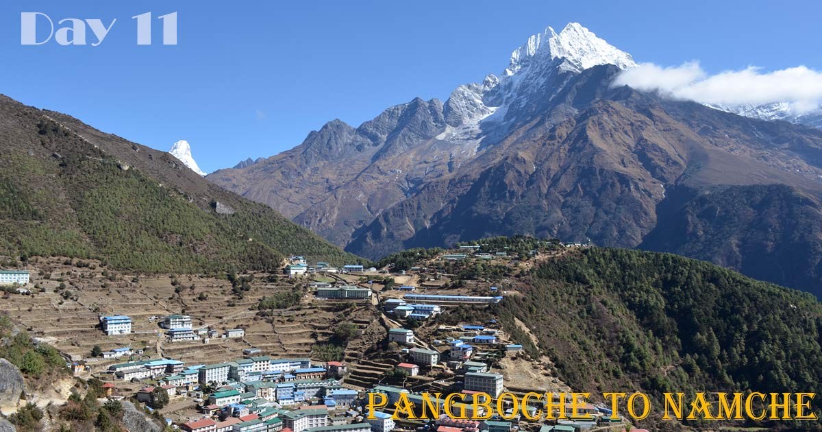
Day 11: Pangboche Trek to Namche
- Elevation of Namche: (3,440 M) 11,284 ft
- Total distance from Pangboche to Namche Bazaar: 19.5 km
- Hours of walking from Pangboche to Namche: 6 hours
- Lunch spot: Tengboche or Phunmgi Thanga
- Overnight at: Namche Bazaar
Leaving Everest Base Camp behind, we retrace our steps on the familiar trail towards Pangboche. Prepare for a difficult initial climb before enjoying a refreshing descent towards a gushing river. Panoramic views greet you as you cross the bridge and continue your descent.
Imagine towering giants like Ama Dablam, Thamserku, Everest, and Nuptse framing your path. Don't forget to steal a final glance at Everest as you approach Namche village. Relax and unwind in Namche, savoring the accomplishments of your trek. Tonight, celebrate amidst the lively village atmosphere, reflecting on the unforgettable journey through the heart of the Himalayas.
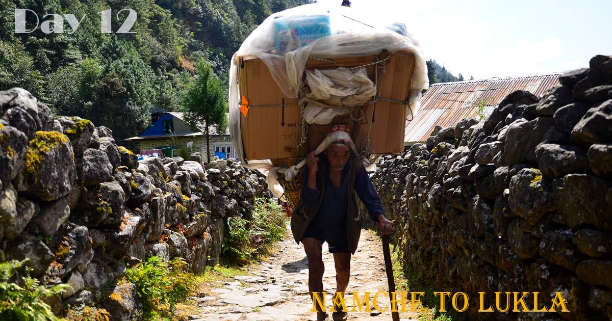
Day 12: Namche Trek to Lukla via Phakding.
- Elevation of Lukla: (2,800 M) 9,184 ft
- Total distance from Namche Bazaar to Lukla: 17.9 km
- Hours of walking from Namche to Lukla: 6-7 hours
- Lunch spot: Monjo or Jorsalley
- Overnight at: Lukla
Despite being the longest walk, this one brings your Everest Base Camp experience to a close. Enjoy the last view of Mount Everest and the breathtaking scenery as you make your way back to Lukla, making the most of every second.
Set out on your trek down the well-traveled path, leaving Namche Bazaar behind. As you descend through verdant valleys, you'll pass colorful prayer flags, charming Sherpa settlements, and gushing waterfalls. Travel over precarious suspension bridges and take in breath-taking views of snow-capped peaks mirrored in the Dudh Koshi River. Take on the last part of your journey after a well-earned lunch break in Phakding. Take in the native way of life in quaint Sherpa towns, cross rushing rivers on robust suspension bridges, and get brief views of spectacular mountains.
You finally reach Lukla after several weeks of strenuous trekking and amazing encounters. Join your fellow hikers in celebrating your accomplishment, and remember to leave a gratuity for your porter team. As you prepare for an early morning journey back to civilization, think back on the priceless memories you've created and pack your luggage.
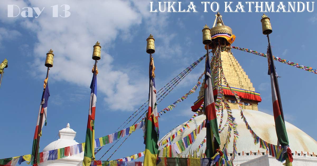
Day 13: Lukla fly back to Kathmandu.
Early morning flight to Ramechhap (Manthali Airport) or Kathmandu. If the flights go to Manthali, then it takes 4 hours to drive back to Kathmandu. Check into a hotel in Kathmandu. Free time for last-minute shopping and massage.
Day 14: Final departure from Nepal.
Transfer to the airport on your flight schedule or continue some other tours and activities in Nepal.
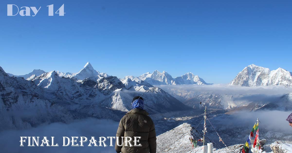
Standing Tall: Reflecting on Your Everest Base Camp Triumph
Your journey to the foot of Mount Everest concludes, leaving behind an indelible mark on your heart. This 14-day odyssey pushed your limits, rewarded your resilience, and unveiled the breathtaking majesty of the Himalayas. As you descend from Lukla, take a moment to savor the memories and celebrate your accomplishment.
Namaste, and until we meet again in the majestic Himalayas!